Packwood, WA - 302 Map
Navigation for the gateway to the Goat Rocks.
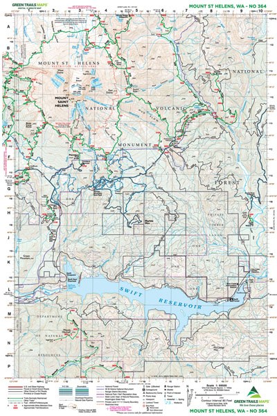
Green Trails Map 302 provides essential topographical detail for the Packwood area, serving as a critical navigational tool for exploring the Tatoosh Wilderness and the approaches to the Goat Rocks. Whether you are planning a trek to Packwood Lake or navigating the forest roads around the Ranger Station, this map offers the reliable trail, road, and access information needed for efficient travel in these rugged landscapes. Revised in 2013, it ensures you have the data necessary to find your way through this key access point for the South Cascades.
Product Information
Product Information
Shipping & Returns
Shipping & Returns
Description
Navigation for the gateway to the Goat Rocks.
Green Trails Map 302 provides essential topographical detail for the Packwood area, serving as a critical navigational tool for exploring the Tatoosh Wilderness and the approaches to the Goat Rocks. Whether you are planning a trek to Packwood Lake or navigating the forest roads around the Ranger Station, this map offers the reliable trail, road, and access information needed for efficient travel in these rugged landscapes. Revised in 2013, it ensures you have the data necessary to find your way through this key access point for the South Cascades.